Seven Lakes Day Trip from Samarkand: Tajikistan's Fann Mountains by 4×4
Cross into Tajikistan for a day at the Seven Lakes: Panjakent bazaar, the lakes of the Fann Mountains by 4×4 and the UNESCO site of Sarazm on the way…

Destinations · Tajikistan
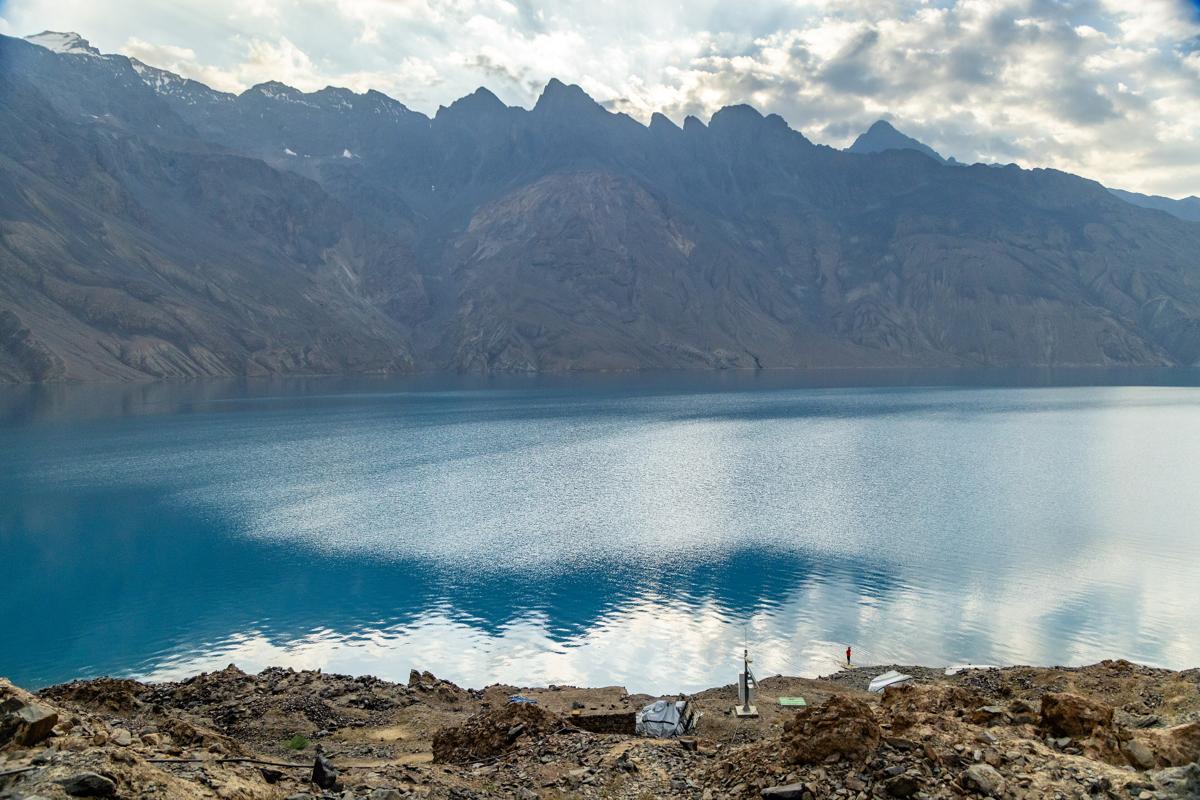
Sarez combines dramatic scenery with a human and geological history that deserves careful explanation. Reaching it is an organized mountain journey, not a routine lakeside drive. For well-prepared visitors, the approach through the Bartang region can be as meaningful as the first view of the water.
At a glance
The history of the lake
In 1911 an earthquake-triggered landslide blocked the river valley, creating the natural Usoi dam and impounding Sarez Lake. The lake's name preserves the memory of a settlement lost as the water rose; Usoi recalls the village buried by the slide. This was a disaster affecting real communities, not simply a picturesque origin story. A guide who connects the terrain with local memory can make the visit more meaningful than a collection of spectacular measurements.
People and living culture
The approach often passes through the Bartang region, home to communities with their own languages, family histories and ways of working the land. Households, schools, cultivated plots and irrigation channels are part of contemporary life. Village hospitality must be arranged, not presumed. Ask before portraits or home visits and pay fairly for accommodation, food, guiding and porterage. The lake's remote shores are not a resort village, and monitoring staff are not automatically tourist hosts.
Everyday life along the approach
Road damage, river conditions, seasonal work and supply journeys influence local life and visitor access. A map does not show whether a bridge, track or guesthouse is usable today. Confirm information with the team actually operating the route. Carry the supplies you need without expecting small settlements to replace missing expedition equipment, and keep waste out of fields, streams and campsites.
Places and experiences
Food and overnight arrangements
Village meals may include bread, soups, rice, vegetables, meat or dairy according to availability; trekking meals need to be carried or organized. Share allergies and dietary requirements in advance. Confirm safe water, tents or shelter, sleeping equipment, toilets and camp permissions. Do not assume that a monitoring station provides beds, meals, a public campsite or a scheduled boat service.
When to visit
The warmer months generally offer the best opportunity, but snow on higher approaches, river levels, rockfall and damaged roads can still stop a trip. A season suitable for one route may not suit a higher crossing. Keep contingency days and a realistic alternative. This is not an all-weather extension to a city stay, nor a trek whose safety can be judged from photographs alone.
Special permissions and hazard awareness
Arrange passport-specific entry, GBAO permission and the separate authorization for the Sarez area before traveling. Confirm the current procedure, required documents, guide conditions and approved itinerary with the competent authorities through an experienced operator. The natural dam and surrounding slopes are monitored because of potential hazards. Monitoring does not mean zero risk or imply an imminent disaster. Follow closures and instructions; public scientific reports are not real-time safety clearance.
Planning a responsible expedition
Select a team familiar with the approved approach, emergency communication and evacuation options. Roads do not reach the lake as a normal sightseeing drive. Plan acclimatization for the highest sleeping altitude, not only the lake level. Do not go higher with altitude-illness symptoms; worsening symptoms require descent and medical help. Insurance must cover the actual trekking altitude, remoteness and evacuation. Swimming, boating, dam access and further crossings are not automatically permitted or safe; each needs explicit authorization and specialist assessment.
Cross into Tajikistan for a day at the Seven Lakes: Panjakent bazaar, the lakes of the Fann Mountains by 4×4 and the UNESCO site of Sarazm on the way…
Cross from Samarkand into Tajikistan for Sarazm, Panjakent bazaar and the Seven Lakes, sleep in a private room above Marguzor, the sixth lake, and drive…
Cross into Tajikistan for a day: Khujand fortress and its museum, the Panjshanbe bazaar in its grand 1960s hall, and the Sheikh Muslihiddin complex.…
Cross into Tajikistan for a night by Iskanderkul, the mountain lake named after Alexander the Great: an easy walk to the Fann Niagara waterfall, a…
Instead of the train, go the long way: across the border to Khujand, over the mountains to Iskanderkul Lake for the night, then down the Zarafshan Valley…
Travel between Samarkand and Tashkent the long way, through Tajikistan: Sarazm, Panjakent, the Seven Lakes up to the seventh by 4×4, a night by Lake 6,…